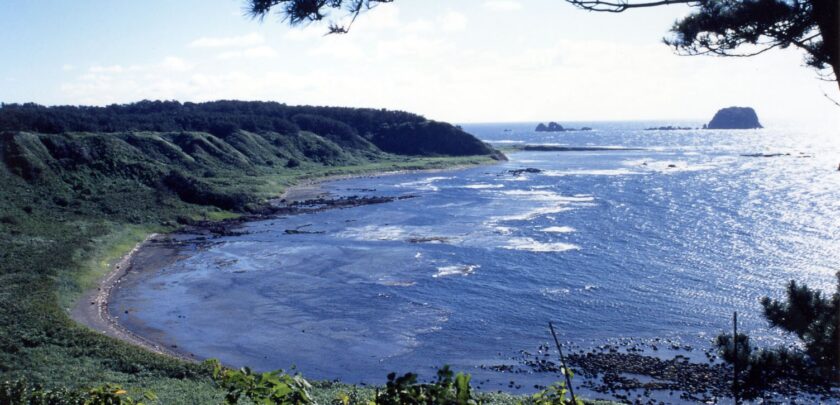
Tobishima Island is approximately 39 km northwest of Sakata Port
at the furthest point north and west in Yamagata prefecture. A
warm current (Tsushima Current) flows around the island, which
has a warm annual average temperature of 12°C or above. Rarely
does snow accumulate on the island. The warm climate brought
by the ocean current produces a mix of flora and fauna from the
north and south.
Tobishima Island is believed to have been formed when earth that
rose from the ocean floor was eroded by waves to form an
abrasion platform that is primarily flat. That tableland has a blend
of broad-leaved evergreen trees such as bay and Eurya japonica
trees, warm-climate plants including Japanese staunton vine and
Pollia japonica, and cold-climate plants that include giant
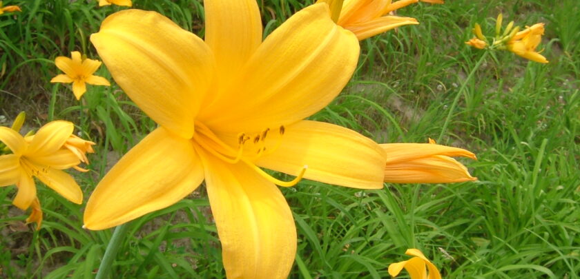
knotweed and Cerastium fischerianum. In addition, colonies of
flowers in the lily family such as the tiger lily and the endemic
species of Tobishima kanzo (Hemerocallis middendorffii var.
exaltata) grow yellow and orange near the seashore in early
summer.
The sea provides a wealth of treasures, including Japanese
common squid and fish such as flying fish that ride the warm
current, cod, rockfish, large species of sea bream, and amberjack.
Tobishima Island is a stopping point for migratory birds. In spring
and fall, many wild birds stop on the island to rest their wings.
Species of birds that are ordinarily difficult to view, as well as wild
birds from the Asian Continent that normally cannot be seen in
Japan, can be observed on Tobishima. So-called rare or stray birds
can frequently be seen.
There are historic ruins dating back to the early Jomon period
(14,000~300 BC) on the island, which was an important location in
the Edo period (1603~1868) when kitamae cargo ships sailing
from Osaka used the island as a port of refuge and to await the
turning of the tide. In addition, Tobishima Island was designated
part of Chokai Quasi-National Park in 1963 and recognized by the
Japan Geopark Committee as a member of the Japanese
Geoparks Network in September 2016.
2024-03-30


